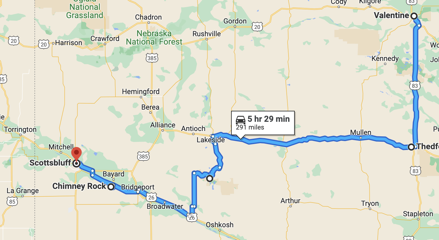
Valentine to Scott's Bluff
This morning I drove west to Scott’s Bluff in the far western region of Nebraska. This is one of those states that splits time zones, so, I gained an hour over the drive, although I will immediately lose it again once I zag east again in South Dakota. I started out in a down jacket, hat and gloves. By midday I was stripped down to a tank top and sandals. This may be the last of the lingering unseasonable heat, but in the meantime, there was a 40 degree spread between morning and afternoon.
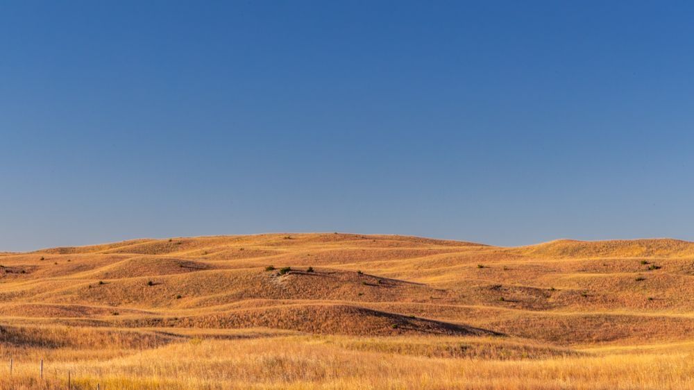
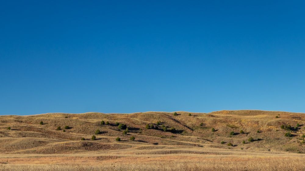
I took a jog south so that I could drive through more of the Sandhills on my way. Most of Nebraska is privately owned, including most of the Sandhill region , so photography was limited to side of the road. In the meantime I was keeping an eye out for a gas station on the long empty stretch of road. Especially in these relatively unpopulated plains states, I have been making sure to start out with a full tank, and I start looking to fuel up at about half a tank. I have noticed that both Google and Garmin miss a lot of the smaller private gas stations, and even some of the more local chains. So when I passed through a small settlement (too small to even call it a town) and saw a pump, I immediately pulled in. This turned out to be a private coop, which I have not previously seen. It seemed to work fine, and when I went in to use the facilities the two people working there were friendly and inviting. I did see a local chain station a few miles up the road, but that was the last one until I arrived in the Scott’s Bluff area hundreds of miles later.
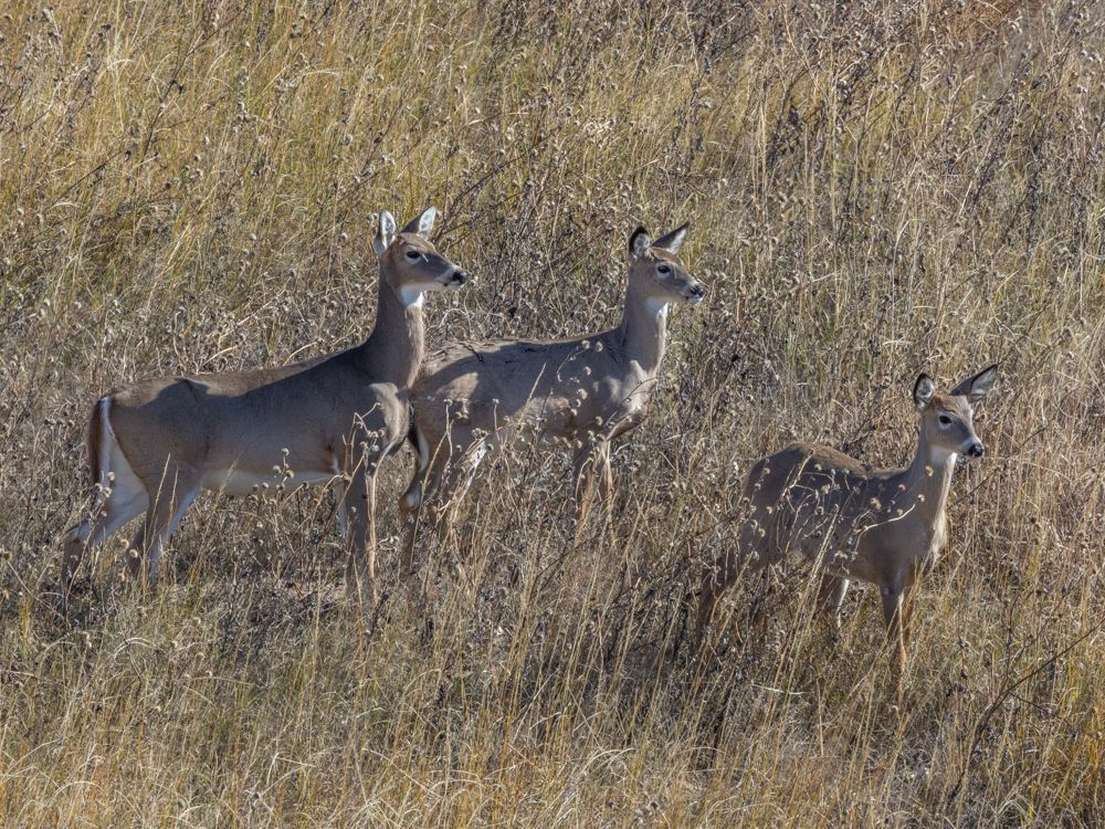
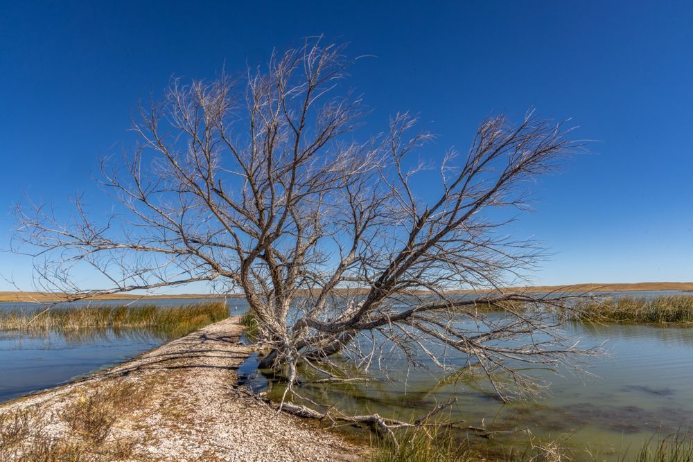
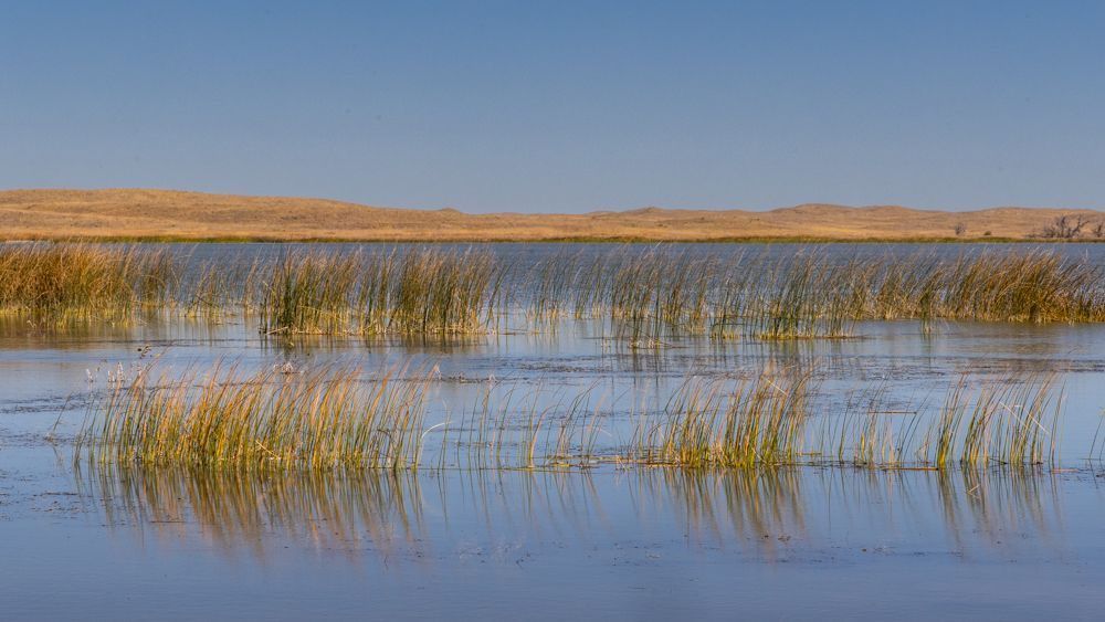
I was very glad I had filled up as Crescent Lake NWR is quite remote. I drove about 30 miles over a very rough road to reach the refuge. My GPS advised that the speed limit was 50 MPH. If I had actually driven at that speed I would have blown out my shocks, and likely a few teeth. Of course, by the time I got there it was midday. Not a cloud in the sky and the temperature had edged over 80. After yesterday’s bird drought, I was relieved to see some waterfowl in the lake, but mostly common ducks, nothing particularly exciting. The lake, reeds and dead trees set against the Sandhills was an interesting landscape, and I did see a few white-tailed deer along the side of the road. The road leading out of the refuge was a bit shorter, but every bit as rough.
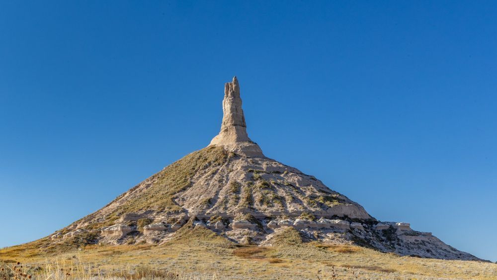
Before arriving at Scott’s Bluff, I stopped at Chimney Rock . This well-known rock formation is also of historical significance as it was a landmark on the western migration route that split off to lead either to California (through Utah and Nevada) or Oregon (through Wyoming and Idaho). The small museum had just received an update and it was well-curated and informative. It documented both the western migration of American settlers, as well as their interactions with the native peoples they encountered. I walked the path to the rock itself and stopped at the parking lot and interpretive kiosk to which I also could have driven. The docent stationed there informed me that this parking area, as well as the trails, had been completed only a few weeks ago. Until quite recently this was private land and Chimney rock could be viewed only from a distance. She was there to orient people and also to make sure that the trails were limited to foot traffic.
Tomorrow I will explore Scott’s Bluff National Monument.
I took a jog south so that I could drive through more of the Sandhills on my way. Most of Nebraska is privately owned, including most of the Sandhill region , so photography was limited to side of the road. In the meantime I was keeping an eye out for a gas station on the long empty stretch of road. Especially in these relatively unpopulated plains states, I have been making sure to start out with a full tank, and I start looking to fuel up at about half a tank. I have noticed that both Google and Garmin miss a lot of the smaller private gas stations, and even some of the more local chains. So when I passed through a small settlement (too small to even call it a town) and saw a pump, I immediately pulled in. This turned out to be a private coop, which I have not previously seen. It seemed to work fine, and when I went in to use the facilities the two people working there were friendly and inviting. I did see a local chain station a few miles up the road, but that was the last one until I arrived in the Scott’s Bluff area hundreds of miles later.
I was very glad I had filled up as Crescent Lake NWR is quite remote. I drove about 30 miles over a very rough road to reach the refuge. My GPS advised that the speed limit was 50 MPH. If I had actually driven at that speed I would have blown out my shocks, and likely a few teeth. Of course, by the time I got there it was midday. Not a cloud in the sky and the temperature had edged over 80. After yesterday’s bird drought, I was relieved to see some waterfowl in the lake, but mostly common ducks, nothing particularly exciting. The lake, reeds and dead trees set against the Sandhills was an interesting landscape, and I did see a few white-tailed deer along the side of the road. The road leading out of the refuge was a bit shorter, but every bit as rough.
Before arriving at Scott’s Bluff, I stopped at Chimney Rock . This well-known rock formation is also of historical significance as it was a landmark on the western migration route that split off to lead either to California (through Utah and Nevada) or Oregon (through Wyoming and Idaho). The small museum had just received an update and it was well-curated and informative. It documented both the western migration of American settlers, as well as their interactions with the native peoples they encountered. I walked the path to the rock itself and stopped at the parking lot and interpretive kiosk to which I also could have driven. The docent stationed there informed me that this parking area, as well as the trails, had been completed only a few weeks ago. Until quite recently this was private land and Chimney rock could be viewed only from a distance. She was there to orient people and also to make sure that the trails were limited to foot traffic.
Tomorrow I will explore Scott’s Bluff National Monument.

61 photo galleries
50 States
- Big Sur
- Salinas
- Laguna Beach
- San Diego
- California
- Grand Canyon
- Sedona
- Utah
- Syracuse
- Moab
- Denver
- Manitou Springs
- Calhan
- Mesa Verde
- Los Alamos
- Santa Fe
- Carlsbad
- New Mexico
- Eureka Springs
- Little Rock
- Birmingham
- Jackson
- Lottie
- Ten Thousand Islands
- Jerome
- Savannah
- White
- Asheville
- Sandstone Falls
- Baltimore
- Timonium
- Maryland
- Berlin
- Milton
- Smyrna
- Ocean City
- Detroit
- Upper Peninsula of Michigan
- Michigan
- Herod
- Ozark
- Two Harbors
- Carlton
- Madison County
- Oakley
- Valentine
- South Dakota
- United States
- Yellowstone National Park
- Lima
- Idaho
- Port Townsend
- Lincoln City
- Newport
- San Francisco